How loud are the planes where you want to live?
Aircraft and road noise and air quality for your street, and flood risk for your area, from official data.
- Free to search
- No cookies
- No ads
Your answer
A street in Kew, under Heathrow’s arrivals. Type your postcode above to see yours.
Nearby
See the full picture on the map
How the planes are counted
About the air readings
Have your say
Spotted something wrong?
What the choices mean
Which places does it cover?
- Bristol 4
- Cardiff 4
- Greater Manchester 10
- Greater Norwich 3
- Leicester 8
- London 33
- Merseyside 5
- Nottingham 4
- South Yorkshire 4
- Teesside 5
- Tyne and Wear 5
- West Midlands 7
- West Yorkshire 5
One postcode
From a postcode to a sourced answer.
A walk through one search. The street is a real example, and every figure in it is the site's own answer for that street today.
01
Type a postcode, a place or a ZIP
Any full postcode in the UK city regions we cover, a council area by name, or a Bay Area ZIP (New York’s are on the full map). A postcode opens on its own street, with the street’s own figures wherever they exist, never the council’s average.
Opens on TW9 3PZ, Kew, in Richmond upon Thames, under Heathrow’s arrivals: the street’s own noise, air and planes. Hounslow, the council area’s card: its score, the five scores behind it and its official figures, with the full scorecard a click away. Palo Alto, the Bay Area city holding half or more of the ZIP’s residents: its score, its facts and the routes over it.
02
Noise, against the WHO guideline
DEFRA’s modelled aircraft and road noise for the postcode, each drawn against the World Health Organization’s guideline, so a reading says how far over it the street is. Where DEFRA does not map aircraft noise, an estimate from the published routes, which says so.
The example’s noise figures appear here as it loads.
03
Air: the model, and what is measured
DEFRA’s model for the postcode’s own 1 km square, beside the nearest Breathe London sensor and DEFRA monitor nearby, on one scale with the guideline drawn through it. The model is a ring, a measurement a solid mark.
The example’s air figures appear here as it loads.
04
Planes overhead, set by the wind
Planes land and take off into the wind, so the wind decides which way an airport flies, and that decides how many pass over a street. Counted from flight tracking, and checked against the CAA’s monthly totals.
The example’s planes appear here as it loads.
05
A page to keep, every figure sourced
Three pages of the official figures for the street you name, each with who published it and when, ready to print or send. Free for your own home.
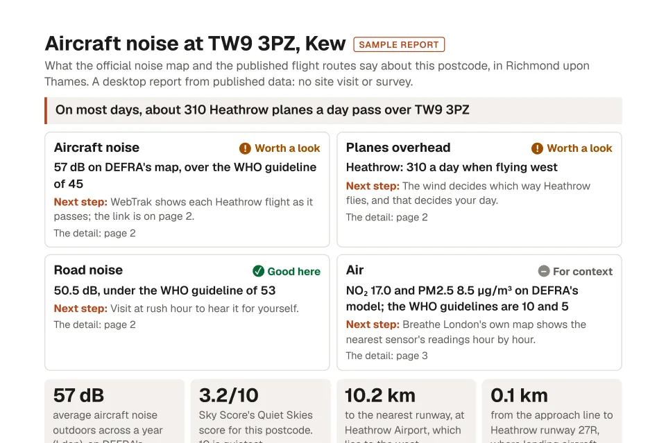
- The headline figures, each against its guideline
- The routes nearby, and how high aircraft are there
- How the postcode compares with its neighbours
- Every source and its year, at the foot of the page
London from above
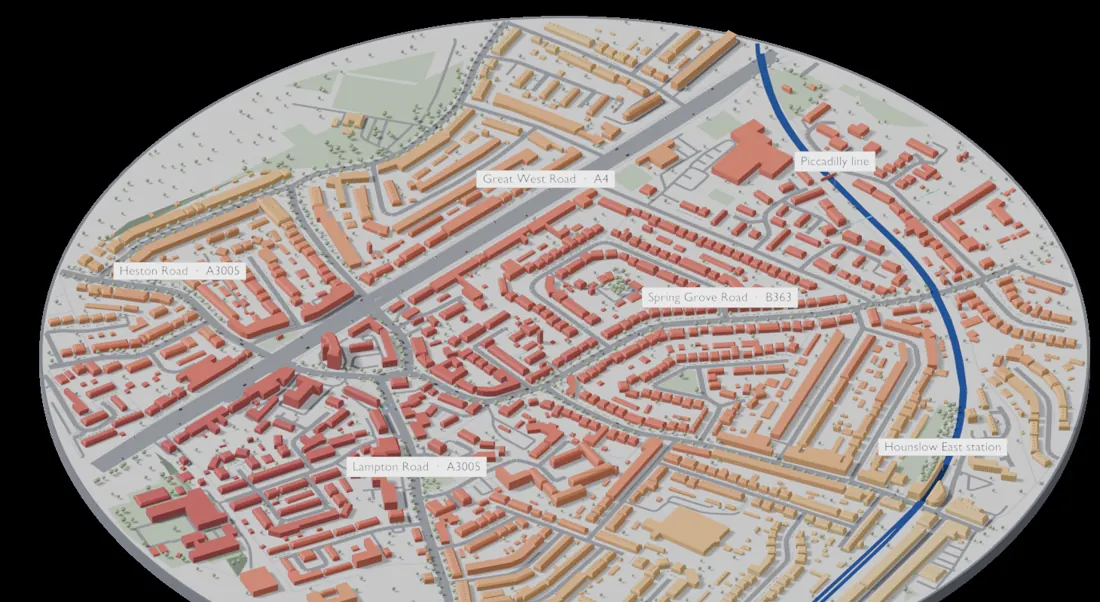
Fly Heathrow’s approach over London.
Follow the planes in over London and watch the noise rise, street by street, to Hounslow.
Fly the approachMore ways in
Beyond one street.
Whole areas, a page to keep, and the same figures for your own system.
Find an area that fits
Set a budget and what you want to avoid or be near, such as aircraft noise, busy roads, flood risk or a station, and see which council areas fit, shaded on the map.
A report for your street
Three pages of the official figures for the street you name, every number with its source and date. Free for your own home and for residents’ groups; a sourced answer for agents and surveyors to hand to a client.
Data for your business
The same figures through an API, in your own system, or as one open file of every UK council area, free for non-commercial use.
For developers
The same figures, one request away.
Send a postcode or a point and get every figure back with its source, as JSON. Noise and air at any point need no key.
10,000 lookups a month on the free tier
curl 'https://2gjfdzg20c.execute-api.eu-west-2.amazonaws.com/prod/v1/environment?lat=51.4790&lon=-0.2860'
import requests

r = requests.get('https://2gjfdzg20c.execute-api.eu-west-2.amazonaws.com/prod/v1/environment',
                 params={'lat': 51.4790, 'lon': -0.2860})
env = r.json()['environment']
print(env['no2AnnualMeanUgm3'], env['roadNoiseLdenDb'])
const r = await fetch('https://2gjfdzg20c.execute-api.eu-west-2.amazonaws.com/prod/v1/environment?lat=51.4790&lon=-0.2860');
const { environment } = await r.json();
console.log(environment.no2AnnualMeanUgm3, environment.roadNoiseLdenDb);On your page
Shortened to fit: the full answer names the source of every figure.
Noise and air at a point in Kew: no key needed.
Heathrow's consultation
See the planes over your council.
Whatever your view, one page for each of the 32 councils Heathrow's flights cross: the planes counted over each of its postcode districts, and its official noise, air and flood figures. Today's flights on today's routes, not those of a third runway. The consultation is open until 22 December 2026.
Find your councilThe 32 councils
The same figures for anyone responding. Sky Score takes no side in the consultation.
- Barking and Dagenham
- Barnet
- Bexley
- Brent
- Bromley
- Camden
- City of London
- Croydon
- Ealing
- Enfield
- Greenwich
- Hackney
- Hammersmith and Fulham
- Haringey
- Harrow
- Hillingdon
- Hounslow
- Islington
- Kensington and Chelsea
- Kingston upon Thames
- Lambeth
- Lewisham
- Merton
- Newham
- Redbridge
- Richmond upon Thames
- Southwark
- Sutton
- Tower Hamlets
- Waltham Forest
- Wandsworth
- Westminster
Who it is for
Choosing a home, or working with them.
Choosing a home
Buying or renting
Find the areas that fit your budget, then check a street before a viewing. Free to search.
Working with homes and places
- Buying agents and relocation firmsA sourced answer before the client asks.See pricing →
- Conveyancers and surveyorsAdd aircraft noise to the reports you already produce.Use the API →
- Islamic home financeEnvironmental checks with an affordability measure that uses prices only.Use the API →
- Residents' groupsStart a bid from the official baseline.Browse council areas →
- Researchers and journalistsOne open, documented file.Get the open data →
Questions
Before you search.
Where do the figures come from?
From public bodies: DEFRA’s noise and air maps, the Environment Agency’s flood maps, published flight routes from the UK AIP (NATS), ONS crime figures, HM Land Registry prices and more. Every figure names its source and its year.
Is aircraft noise measured?
Mostly it is modelled: DEFRA’s map where DEFRA maps aircraft noise, and an estimate from the published flight routes elsewhere, which says so. The air section adds measured readings from the nearest Breathe London sensor and DEFRA monitor. More in How it works
How are the figures checked?
The planes counts are checked against the CAA’s monthly totals for each airport, and an airport is counted only once its counts pass. Where DEFRA does not map aircraft noise, the estimate from the flight routes is published with its error against DEFRA’s own maps. More in How it works
Which places does it cover?
97 council areas in 13 UK city regions, plus New York's 5 boroughs and 50 Bay Area cities.
Is it free?
Searching is free. Reports and the API have free and paid options: see Pricing.
Can I use it for my business?
Yes: through the API, in your own system, or as one open file of every UK council area, free for non-commercial use. Book a demo to go through your own postcodes.
Book a demo
Bring your own postcodes.
In 30 minutes we go through the places you work with: the figures for each, and where every one comes from. Nothing to prepare.

Built by Bilal Khizar, so you can make a more informed decision when choosing where to live.
Our story →