A more informed decision when choosing where to live
That is the whole reason Sky Score exists. A listing shows you the kitchen. It rarely tells you about the aircraft overhead, the road outside, the air or the flood risk, so we put those beside every postcode we cover, from the organisations that measure them, and say plainly where a figure is our own estimate.
 Bilal Khizar, founder

Why I built it
I went to a property viewing, and while I was there a plane flew low overhead. The listing hadn't said a word about it.
Aircraft noise, road noise, air quality and flood risk are all published by the bodies that measure them, but no property site puts them all in front of the person deciding where to live. I started Sky Score at an AWS hackathon, honestly for the cloud credits, and kept building it because it was the tool I wanted when I was looking for a home.
What you can hold us to
- Every figure has a source.Each one comes from the organisation that measured or published it, and is credited to them.
- Our own figures say so.Where a figure is ours, such as the score itself or the Quiet Skies estimate, it is labelled as ours, and How it works shows the sums.
- Nothing is made up.Every number traces back to published data, and none is invented by an AI.
- No cookies, no account.Searching needs no sign-up, and the site sets no cookies.
The figures come from the organisations that publish them, among them DEFRA, the Environment Agency, the ONS, HM Land Registry, the Department for Education, the Department for Transport, the NHS, the UK AIP (NATS) and Breathe London, and in the US the FAA, the US Census Bureau, the Bureau of Transportation Statistics, FEMA and the EPA. Where the data comes from, with each licence.
How it grew
-
The first map
London's flight paths on one map, with New York's beside them. I entered it in an AWS hackathon, where it won a blog-post prize.
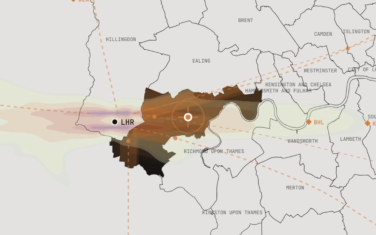
The first map, from the hackathon entry. -
Sky Score Radar
A prototype of London's airspace in 3D, with simulated flight tracks over the terrain. Try the prototype.
-
Data first
Every figure now comes from the organisation that measures it, or is marked as our own estimate. Work began on an API, so businesses can use the same figures.
-
An iPhone app
On the App Store, with a button that scores the place you are standing.
-
Beyond London
Nine more English city regions, from Greater Manchester to Teesside.
-
Deen Developers' Build Night
No pitching allowed: you open the thing and use it live, in front of everyone. So I did.
-
AI Tinkerers London
I talked through the map on the big screen. The talk page and recording (sign-in needed).
-
Flight paths from the official routes
After feedback on Reddit, London's flight paths were redrawn from the routes published in the UK AIP (NATS).
-
The Bay Area, and the air nearby
Fifty Bay Area cities, first as facts and, since November, scored on US scales, and the air measured near a postcode, from Breathe London's sensors and the government's monitors.
-
London Geo Meetup
“From hackathon to live map”: the stories behind the map, told online.

Every change, with its date: What changed, and when.
Questions people have asked
Asked out loud, by the audience at a talk.
- Does it rank all the places in London, best and worst?
- Yes, and the order depends on what matters to you: a family, a first-time buyer and an investor each get a different ranking. Open the full map.
- Can you see how it changes over time?
- House prices update every month. The official aircraft and road noise maps are from 2021, a lockdown year with fewer flights, and the full map says so. What changed, and when.
- Could you forecast the noise from a new runway?
- Not yet. Sky Score describes the routes flown today; it doesn't guess at a runway that hasn't been built.
- Is it the land or the building? A flat on a high floor hears a road differently.
- It's the postcode, not the floor: a penthouse and a ground-floor flat at the same postcode get the same road noise and air quality. How a score is worked out.
- What made you build it?
- A plane overhead at a viewing, and a listing that said nothing about it. The story.
Talks and demos


- Deen Developers' first Build Night, 30 July 2026: a live demo
- AI Tinkerers London, 22 September 2026: the talk page and recording (sign-in needed)
- London Geo Meetup, 14 October 2026: “From hackathon to live map”, a talk and live demo, online
- The handout from the talks: how Sky Score works, from a postcode to a score
Who it's for
Anyone choosing a home, and the people who work with homes and places. Who it is for, and where each one starts.